Jual Peta Laut 274 Original – Pushidrosal Laut Maluku Pulau-Pulau Sula Bagian Barat
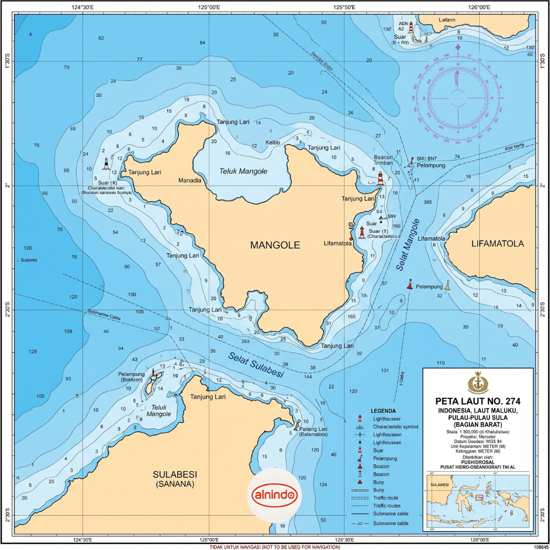
Mencari Peta Laut 274 original untuk kebutuhan navigasi, pelayaran, operasional kapal, maupun referensi kelautan? Peta Laut No. 274 merupakan peta navigasi resmi yang diterbitkan oleh Pushidrosal, mencakup wilayah Laut Maluku di sekitar bagian barat Pulau-Pulau Sula.
Peta laut resmi menjadi salah satu perangkat penting untuk membantu pelaut, nakhoda, operator kapal, instansi maritim, serta pelaku usaha perikanan dalam memahami kondisi perairan dan merencanakan pelayaran dengan lebih aman. Pesan Peta Laut No. 274 melalui WhatsApp 081586838888 atau kunjungi Alnindo dan Alnindo Indonesia untuk memperoleh informasi harga spesial.
Peta Laut No. 274 Original Pushidrosal
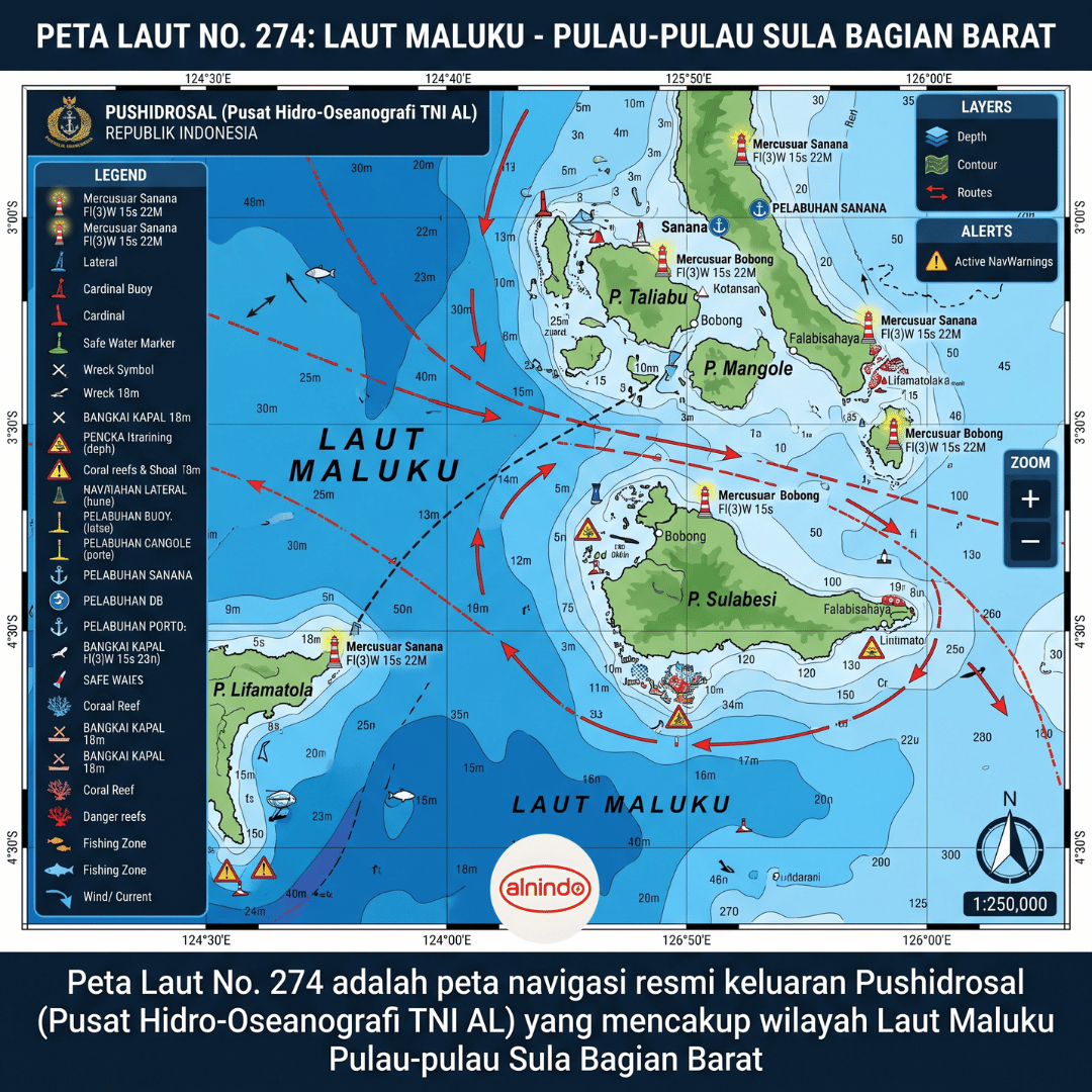
Peta Laut No. 274 adalah peta navigasi yang diterbitkan oleh Pushidrosal (Pusat Hidro-Oseanografi TNI Angkatan Laut), yang sebelumnya dikenal sebagai Dinas Hidro-Oseanografi TNI AL. Peta ini dirancang sebagai alat bantu navigasi dalam mendukung keselamatan dan ketepatan pelayaran pada area perairan yang dicakupnya.
Wilayah utama pada Peta Laut 274 meliputi Laut Maluku, khususnya area di sekitar bagian barat Pulau-Pulau Sula. Kawasan ini memiliki arti penting bagi pelayaran antarpulau, aktivitas logistik, kegiatan perikanan, mobilitas kapal, survei kelautan, dan kebutuhan operasional lainnya di wilayah Indonesia Timur.
Dengan menggunakan peta laut original, pengguna memperoleh informasi kartografi kelautan yang diperlukan untuk membaca karakteristik perairan secara lebih sistematis sebelum maupun selama pelayaran.
Peta Laut No. 274 memiliki informasi utama sebagai berikut:
-
Nomor peta: Peta Laut No. 274
-
Penerbit: Pushidrosal atau Pusat Hidro-Oseanografi TNI AL
-
Wilayah cakupan: Laut Maluku, sekitar bagian barat Pulau-Pulau Sula
-
Kegunaan: Membantu kebutuhan navigasi dan keselamatan pelayaran
-
Jenis produk: Peta laut navigasi resmi/original
-
Pengguna potensial: Kapal niaga, kapal perikanan, kapal wisata, kapal pendukung operasional, instansi pemerintah, lembaga pendidikan, survei kelautan, dan kolektor peta maritim
Peta laut bukan hanya dokumen visual mengenai wilayah perairan. Dalam kegiatan pelayaran, peta berperan sebagai referensi untuk memahami jalur yang direncanakan, kondisi perairan, potensi bahaya, hingga tanda-tanda bantu navigasi yang tersedia di suatu area.
Sebagai peta navigasi, Peta Laut No. 274 memuat berbagai elemen penting yang relevan bagi perencanaan dan pelaksanaan pelayaran. Informasi tersebut antara lain meliputi:
-
Garis pantai dan bentuk wilayah pesisir
-
Kedalaman laut atau data batimetri
-
Kontur serta karakteristik dasar laut
-
Alur atau jalur pelayaran
-
Rambu-rambu dan tanda bantu navigasi
-
Penanda bahaya pelayaran
-
Informasi geografis lain yang mendukung pembacaan kondisi perairan
Data kedalaman laut sangat penting untuk memperkirakan keamanan lintasan kapal berdasarkan draft atau sarat kapal. Sementara itu, informasi kontur dasar laut dan tanda bahaya membantu pengguna mengenali perubahan kondisi perairan, area dangkal, serta lokasi yang perlu diwaspadai.
Pemanfaatan peta laut perlu tetap disertai pembaruan informasi pelayaran yang berlaku, prosedur keselamatan, pengetahuan navigasi yang memadai, serta penggunaan perangkat navigasi lain sesuai kebutuhan operasional kapal.
Manfaat Menggunakan Peta Laut Original
Menggunakan Peta Laut 274 original memberikan sejumlah manfaat bagi pengguna yang membutuhkan referensi navigasi wilayah Laut Maluku dan Pulau-Pulau Sula bagian barat.
-
Membantu menyusun rencana rute pelayaran secara lebih terarah
-
Mendukung identifikasi kedalaman perairan dan kondisi dasar laut
-
Membantu mengenali jalur pelayaran serta titik-titik yang perlu diperhatikan
-
Menjadi referensi pendukung untuk kegiatan navigasi kapal
-
Berguna untuk kebutuhan survei, pendidikan, dokumentasi, dan kajian kelautan
-
Mendukung kesiapan operasional pada area Laut Maluku dan sekitarnya
Untuk kegiatan pelayaran, penting memastikan peta yang digunakan adalah edisi yang sesuai serta telah diperbarui menurut informasi resmi yang berlaku. Jika diperlukan, hubungi penyedia untuk memperoleh informasi produk, ketersediaan, dan kebutuhan peta laut yang sesuai dengan wilayah pelayaran Anda.
Jual Peta Laut 274 Original di Alnindo
Alnindo menyediakan kebutuhan peta laut untuk mendukung operasional maritim, navigasi, pendidikan, dan kebutuhan referensi kelautan. Bagi Anda yang memerlukan Peta Laut No. 274 wilayah Laut Maluku Pulau-Pulau Sula Bagian Barat, silakan hubungi tim kami untuk menanyakan stok, harga, serta informasi pemesanan.
Untuk pemesanan Peta Laut 274 original, hubungi WhatsApp:
081586838888
Anda juga dapat mengunjungi website resmi kami untuk mendapatkan harga spesial:
Alamat kantor kami:
Perkantoran, Jl. Taman Palem Mutiara No. 1 Blok A18, RT.7/RW.14, Cengkareng Tim., Kecamatan Cengkareng, Kota Jakarta Barat, Daerah Khusus Ibukota Jakarta 11730.
FAQ Peta Laut 274 Original
Apa itu Peta Laut No. 274?
Peta Laut No. 274 adalah peta navigasi resmi keluaran Pushidrosal yang mencakup wilayah Laut Maluku di sekitar bagian barat Pulau-Pulau Sula.
Siapa penerbit Peta Laut 274?
Peta Laut 274 diterbitkan oleh Pushidrosal atau Pusat Hidro-Oseanografi TNI Angkatan Laut.
Apa kegunaan Peta Laut 274?
Peta ini digunakan sebagai alat bantu navigasi untuk mendukung pelayaran yang lebih aman, terutama pada wilayah Laut Maluku dan sekitar Pulau-Pulau Sula bagian barat.
Peta Laut 274 dapat memuat informasi seperti garis pantai, kedalaman laut, kontur dasar laut, alur pelayaran, rambu navigasi, serta tanda atau area bahaya pelayaran.
Apakah Peta Laut 274 cocok untuk kapal perikanan?
Peta laut dapat digunakan sebagai salah satu referensi navigasi bagi kapal perikanan yang beroperasi pada wilayah cakupannya. Pengguna tetap perlu memastikan kesesuaian edisi peta, pembaruan informasi, serta prosedur keselamatan pelayaran yang berlaku.
Bagaimana cara membeli Peta Laut 274 original?
Untuk pemesanan, hubungi WhatsApp 081586838888 atau kunjungi Alnindo dan Alnindo Indonesia untuk informasi harga spesial dan ketersediaan produk.



 Konektor